
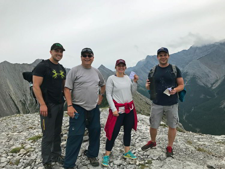
On the Heart Mountain hike near Canmore, an ordinary human can summit up to three mountains in a single day. That’s something worth bragging about, but in all honesty that wasn’t my main motivation for doing it. My son, Brady suggested we do the hike as a family, and I couldn’t resist. I always try to say yes whenever my children ask if I’d like to do something with them. Hiking adventures are better when you share them with people you love. Bragging rights from the Heart Mountain hike were just a bonus.
There are affiliate links in this post. If you make a qualifying purchase through one of these links, Wander Woman Travel Magazine may receive a small commission at no extra cost to you.
Table of Contents
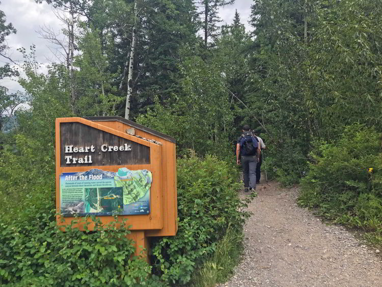
Heart Creek Trailhead and Day Use Area
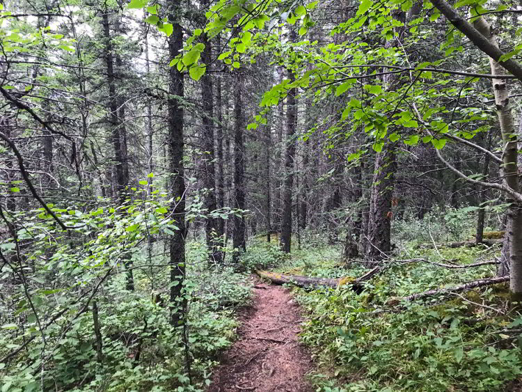
You’ll find the trailhead for the Heart Mountain hike at the Heart Creek Day Use Area in Bow Valley Wildland Provincial Park. It’s a 22-minute drive south-east from Canmore in Kananaskis Country. Since this mountain trail is in a provincial park, you don’t need a national park pass to access it. Take the Lac des Arcs exit and follow the highway signs for Heart Creek and you’ll find it. Here’s a link to the location on Google Maps.
Heart Mountain Hike or Heart Mountain Horseshoe Hike?
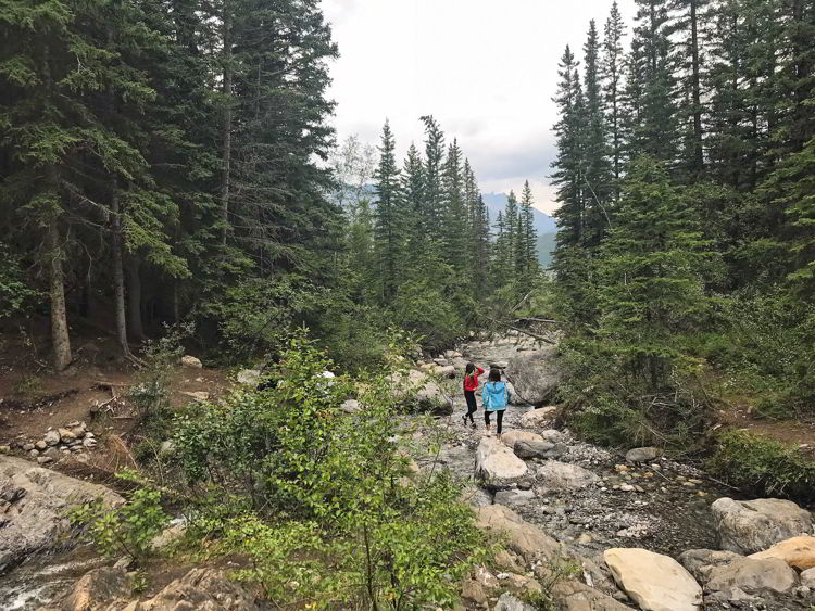
The Heart Mountain Hike is 2.8 kilometres (1.75 miles) one-way. You can go up and back down the way you came for a total distance of 5.6 kilometres (3.5 miles) and one peak summit. Or you can opt to hike the Heart Mountain Horseshoe doing a ridge walk that lets you summit three peaks and is 10.3 kilometres (6.4 miles) in total length. We chose to hike the horseshoe loop trail. People who are very fit said they did it in five hours. My husband and I are not very fit and we stopped for lunch and a lot of pictures. It took us seven hours to complete the hike. The up and back hike has an elevation gain for 745 metres (2444 feet) and the loop trail has an elevation gain of 940 metres (3084 feet). I was “feeling the burn” for several days afterwards.
Related: Check out our post How to go Glamping in Alberta.
What to Bring on the Heart Mountain Hike
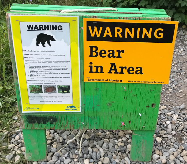
This hike is extremely steep and retractable hiking poles can be very useful. Bring a day pack, hiking snacks, a water bottle, a hiking hat, bear spray and good hiking shoes. I have a pack with a water bladder in it that I like taking on day hikes, because it saves having to pack a separate water bottle. If you’re doing this hike in winter, you’ll need ice cleats. It would be difficult to do the Heart Mountain Horseshoe Hike in inclement weather of any kind. It’s very steep and it can be windy at the top. Snow or rain could make it slippery. Snow could also make it more difficult to find the loop trail and make you more likely to get lost. If you’re doing this hike in winter, just do the up and back version and do it carefully on a good weather day.

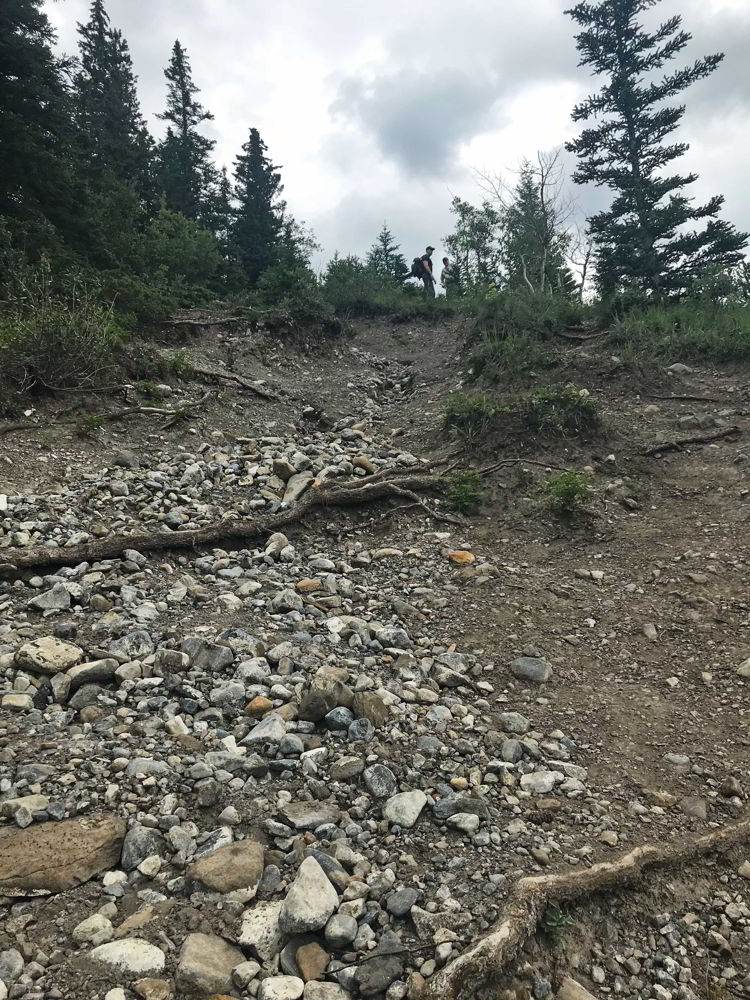
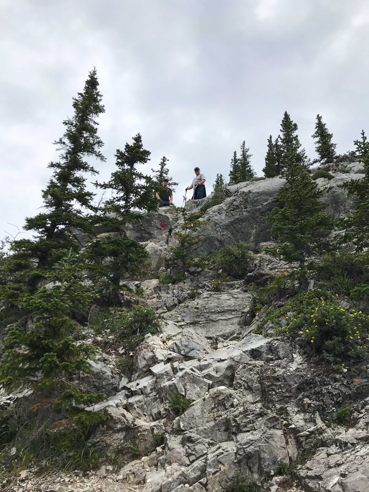
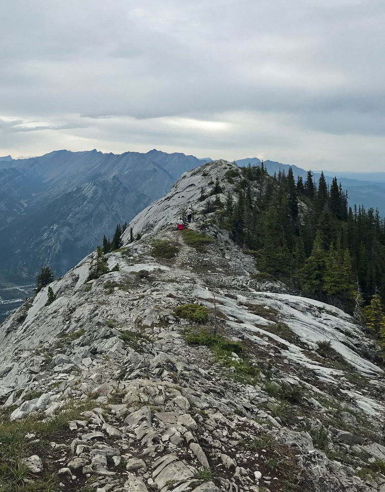
It’s a Scramble
Shortly after we set out on the Heart Creek Trail, we saw a yellow warning sign notifying hikers that beyond this point the trail is a scrambler’s route that might require the use of hands and feet. Just past the sign is a very steep trail up the mountain. There’s a 745-metre (2444 feet) elevation gain to get to the peak of Heart Mountain, plenty of loose scree (rocks) and several points that are a bit tricky to pass. The rule of thumb on this hike is to always go left and to look for faded red diamonds that mark the route. There are trails to the left that take you on a safer and easier route to bypass some of the rock bands that would be difficult to scramble over.
How Heart Mountain Got it’s Name
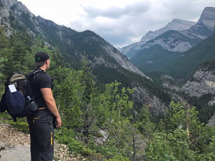
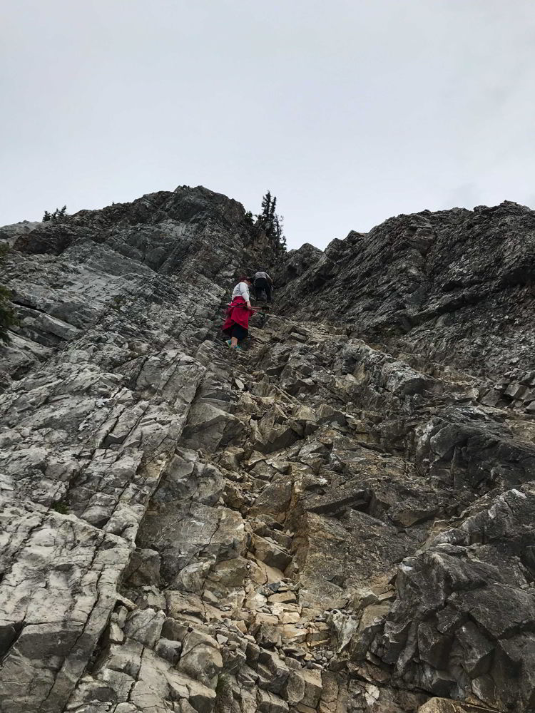
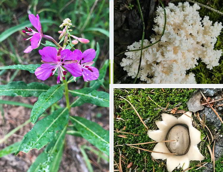
Heart Mountain was named in 1957 for a heart-shaped layer of limestone near the top and the steepest climb is referred to as the crux of the heart. We found faded red triangles that mark the suggested route and navigated up the rocky face to the plateau above. In my case, it took my own hands and feet as well as a hand up from a younger hiker to reach the top, but it was worth it. The view from the top of the mountain is awe-inspiring. We ate our lunch and took pictures along the plateau, which is technically the false summit, before we continued along a trail that led to the actual summit of Heart Mountain at 2135 metres.
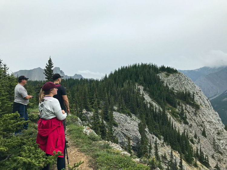
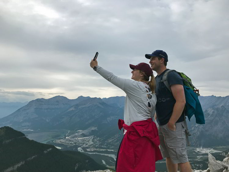
Ridge Walk to Grant MacEwan Peak
We walked along the ridge east of Heart Mountain and ultimately reached Grant MacEwan Peak, the second summit of the hike. In 2006, this peak was officially named for the former lieutenant-governor of Alberta. At 2149 metres, it is the high point along the ridge. We signed our names in the summit register and took in another expansive view of mountains, meadows and forests.
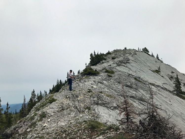
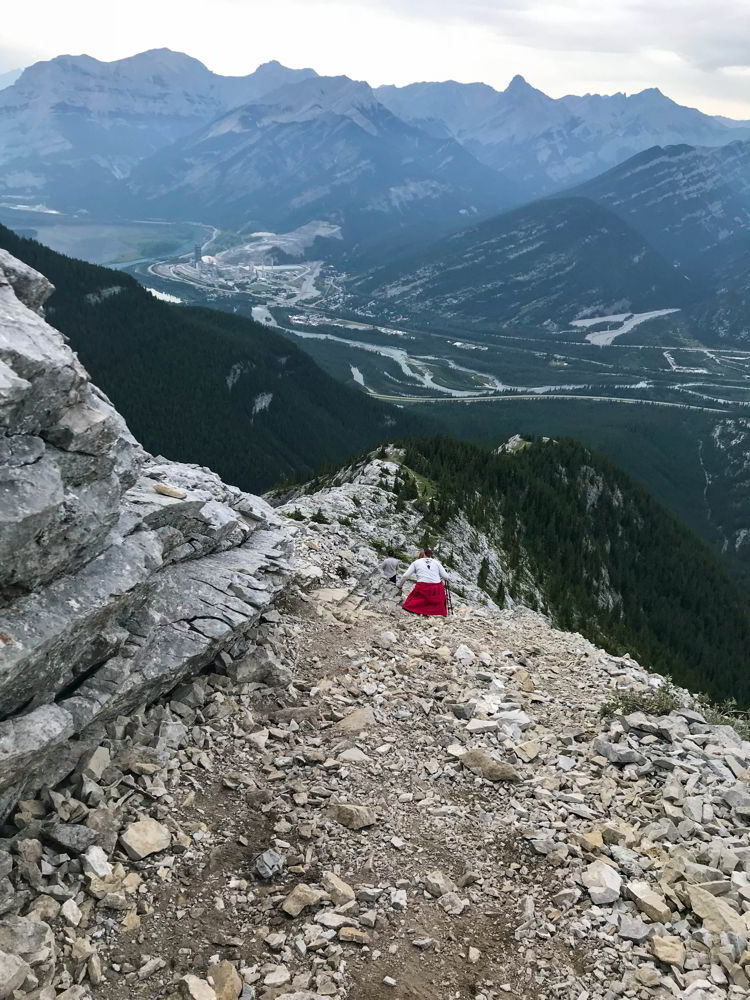
The third peak on this hike doesn’t have an official name, but it is marked by a stone cairn. Once we reached it, we began the descent down a scree-covered rocky path that eventually led to a wide dirt trail through the forest past Quaite Creek and back to the parking area.
Summiting three peaks in a day wasn’t as difficult as I imagined, but it wasn’t easy either. The best thing about it, or any adventure for that matter, is who you share it with.
Trail Tips
- Heart Mountain Horseshoe is about 10.3 km with a 935-metre elevation gain. It’s ranked moderately difficult. It can be hiked year-round, but it sometimes gets very windy at the top and you shouldn’t do this hike if it’s icy. It’s best to hike the loop counter-clockwise, so you’re climbing up the steepest part instead of climbing down it.
- There is no shade and the hike can be very hot on a sunny day. Take plenty of water, snacks, hiking poles and bear spray. (We saw bear droppings on the lower section of the trail.)
- The trailhead is 18 km east of Canmore by the Lac Des Arcs exit. Follow the signs for Heart Creek to the parking lot on the south side of the Trans-Canada Highway.
Related: Read our post about Hiking to Troll Falls in Kananaskis Country.
2 Comments
Darius
Thank you so much for the detailed description of this hike!!! awesome content and got me excited knowing where we going and what to expect
wanderwoman
You’re welcome Darius! Thanks for taking the time to comment. I hope you enjoy the hike! Let us know how it goes and if you have any tips for other hikers. -Debbie